Site 64
Okefenokee National Wildlife Refuge
Today is election day and I've long since sent in my ballot to vote for a second term for my very hard working and honest Congressman Tom Perriello. I know that is hard to believe....a hard working, honest congressman and perhaps it is because he is young and idealistic. I was very disappointed to hear that he had been defeated by 5% of the vote by a man I believe to be a fanatic and dishonest fear monger. Why do the people in this district allow themselves to be so manipulated by TV ads? Maybe it's time to change my residency. Anyone want to suggest some place with better politicians, affordable health care, and reasonable tax rates?? Enough real life and back to wonderful life.
We were up, had a leisurely breakfast and packed up for our first venture into the swamp. I had been to the park's East Side 4 years ago, the year before the fire, thanks to a generous and wonderful birthday gift trip from my friend Lynda. Thanks Lynda. One of my greatest birthdays ever for sure! So I was very anxious to to get a look at this side of the refuge. Wish she were here to see it with me.
We drove the kayaks down to the end of the canal road, took them off the car, loaded them with our gear, took the car back to the parking lot across from the Visitor's Center and shoved off from the bank side launch.

Because of the extreme drought, the canal was very shallow and we had to pole through several sections.

But it is a short canal and we soon found ourselves in Billy’s Lake named for an Indian Chief called Billy Bowlegs by the settlers. He and a band of Seminole Indians took refuge on an island in the lake during the second Seminole Indian War of 1845.

As we enter the lake this sign gave us several options. Which way to go?
You can read all of our choices if you click the picture.

Around the corner was the first of many eyes that watched us all day long. Click the picture for a better look.

We turned right and headed up the bank. The water levels here are noticeably lower even than in Ocean Pond.

It was a gray skies, black water beautiful day and we were experiencing the spell of the swamp as we paddled along “up stream” against the almost negligible current of the slow moseying water

At the sign for Minnie’s lake we took a left turn up a passage way that even in normal water levels is narrow. We'd been warned at the Visitor's Center that we wouldn't be able to go very far. With water levels so low, they were not renting boats of any kind so the only folks on the lake this day were those of the few who brought their own. That meant almost no other people and best of all NO POWER BOATS.

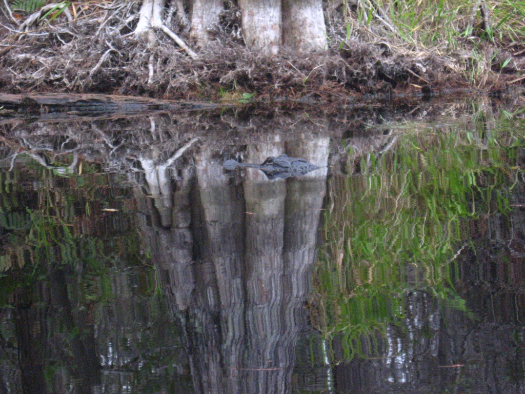
Right before I took this shot, the alligator was floating on top of the water and I watched as he slowly, with not a ripple, sunk underneath the water until only his eyes and nose were above. Right after this he completely disappeared without a trace.
As we paddled the lilies increased on every side and the channel got narrower.

These exposed roots show again what an extreme stage of drought the refuge is in. I do hope they get rain soon even if it means we are unable to go out on other trips. We'll just hunker down and wait for it to let up and experience the rejuvinating effects of the rain.

The choices from here are difficult even to see.

At times, it looked like there was no where to go.

The water kept getting more and more shallow.

We came to a really narrow passage with a white sign.

Now this was a struggle to pole my way through.

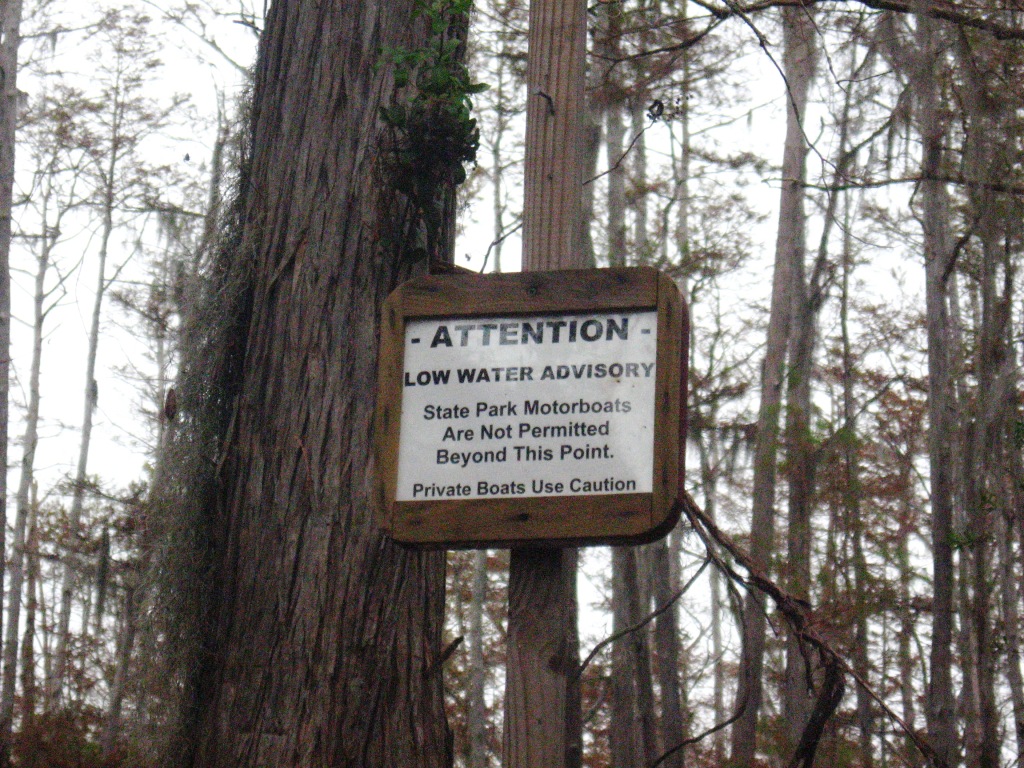
This sign urged caution which was actually not what I needed to get through this low narrow spot. But I can appreciate that even a canoe probably couldn't go here which made it all the more fun to try to see what was just ahead.
The other side turned out to be even lovelier if that's possible. Notice that the cypress trees on my right seem to have red bark and those on my left gray. It was as if the two sides of the water had two types of cypress but we wondered if the soil was responsible and perhaps the fire damage changing the soil on the right hand bank was the reason their colors were different.
But as you can see, we'd reached the end of what we could paddle and to go further would mean to just get out and walk. So reluctantly we turned around and headed back.

We assume we never got as far as Minnie's Lake but with the water levels who knows what a lake looks like.

So quiet and tranquil in the middle of the swamp. We saw only two other boats the entire day. One when we first launched with two men who went out to the end of the canal and did some fishing and we saw one other man when in a kayak as we made our way back


We chose to go the other way and continue on. Hope the sign wasn't an omen. :-)
I passed this hollow trunked cypress and wondered how, if I can see right through it, it is living on the ramaining sides of the trunk. If you click the picture, you'll see this is not two trees, but one

We continued on toward the end of the lake where Billy's Island is located.
Billy's Lake is the largest lake in the refuge at 60 acres. It is 3.5 miles long.

I spotted this fellow hiding in the lilies

Not too far away from these ibis. Better beware guys.
The white ibis are the adults and the brown are juveniles I've learned.

The gators were everywhere on this sunny day. This juvenile barely fits on the perch he chose.

At this point we were approaching Billy's Island one of the largest islands in the swamp at 4.25 miles long and 1.5 miles wide and definitely the one with the most interesting history that we know of.

We pulled over and managed to get the boats beached and ourselves out onto the island

There is an orange blazed trail which this time was not at all hard to find. Those of you who have been following along with us will know about our search for a previous orange trail marker.
An information sign gave a brief history of the island telling us that the original claim to the island was made in 1853 by James J. Lee who later sold it to a relative James "Black Jim" Lee whose son Dan bult a cabin, cleared land for farming and with his wife raised 14 children in the dense wilderness. In 1908 the State of Georgia sold Lee's island home with a large section of the Okefenokee to a private lumber company for harvesting the cypress timber. The lumber company built a thriving community of 600 inhabitants with a post office, movie theater, school, bar, hotel and of course lodgings for the workers.

There is no sight of any of that here now. But there are clear indications of the 2007 fire.

On our walk we were pretty much ignored by this current resident of the island and several others.

The trail circled back to the dock just beyond which we'd left our kayaks. As you can see, at normal water levels you could expect to paddle right up to the dock and get out. No water even near the dock now. Levels are 3 feet or more below normal.

With a 6pm off water time we headed back up to the canal and you can guess who we saw along the way.

We reached the canal and paddled/poled our way back.

David was first to arrive and then

Sir Galahad pulls his lady fair ashore so she will not have to get her dainty feet in the muck. Eat your heart out lady kayakers!!

And that's just a small piece of the 338 photos we took on our first full day as swampers. It was hard work picking these out of the masses but I know you're glad I didn't subject you to them all.
After a 6.5 hour paddling day we were tired but you can bet we'll be back out on the water tomorrow to do the other end of Billy's Lake. Hope you'll come along.


.jpg)

